Does Shillong Even Have a Traffic Problem?
Notes from onboarding a city with no traffic lights. I went in assuming Shillong barely had a traffic problem, and came back convinced this product might matter more to small, growing cities than to the big, broken ones we usually build for.

A few months back, someone from the Shillong team reached out on LinkedIn for a TraffiCure demo. My first honest thought was one I am not proud of: does Shillong even have a traffic problem? Why would they need us?
I was wrong, in a way that has changed how I think about every city that is not a metro. This is what the trip taught me.
Why I almost sent someone else
The online demo went well enough that it turned into an invitation to present in person to an important decision-maker in the state government. Even then I hesitated. Was it worth flying out? Was there a direct flight from Delhi? Should I send someone from sales instead?
What tipped it had nothing to do with the deal. A friend told me Shillong was one of the most beautiful places he had seen in India, so I booked the tickets and went myself.
Not a hill station
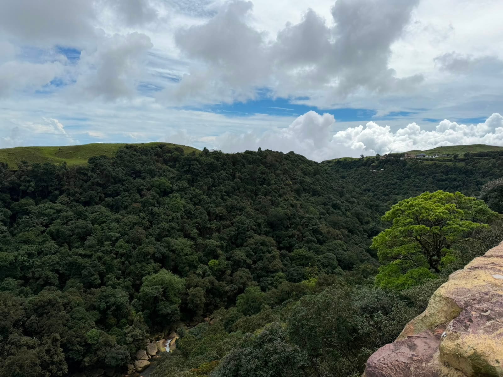
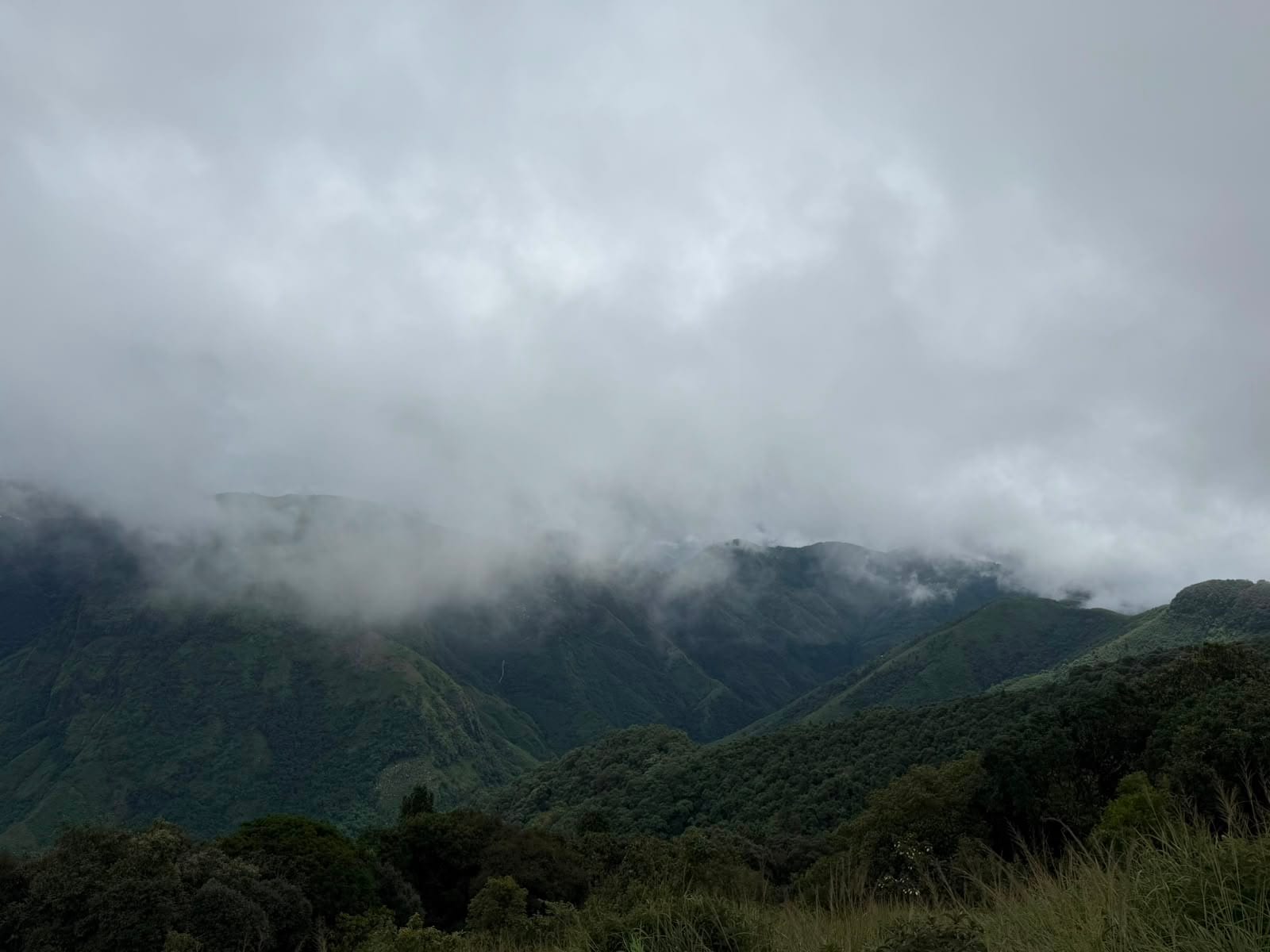
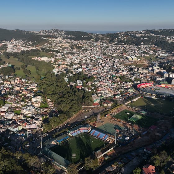
We landed in Guwahati early morning and took a cab up into the hills, and that drive alone was one of the best I've had in this country, the highways, the scenery, all of it. Shillong itself surprised me more than the drive did. I'd expected something like a Mussoorie or a Shimla, a hill station built around tourists. It wasn't that at all. It felt like an actual city, mostly populated by locals, built for locals, that happens to sit in the hills. The roads were busy, but nowhere close to Gurgaon.
No traffic signals. Not one.
What genuinely surprised me was learning the city has no traffic signals. Not one. At its major junctions and roundabouts, several of them still laid out on what I'm guessing is the same British-era street plan, a police officer manually directs traffic from each approach, one side at a time. I'll come back to this, because by the end of the trip it mattered more than I expected. Scrolling through the city on Google Maps, I could see the road network was bigger than I'd assumed too, easily a few hundred kilometres, which made the whole no-signals thing even harder to square.
The question I probably shouldn't have asked
Going into the meeting, I asked the team something I probably shouldn't have: what makes a city like Shillong want TraffiCure, when the traffic doesn't look that bad? It might have been a bad question, but I was genuinely curious. To be clear, the meeting itself was going well, the director was engaged and things felt positive, which is probably what made me comfortable enough to ask it. Underneath the question was something I hadn't quite admitted to myself. Our data comes from probe traces, essentially the anonymized movement of phones running Google Maps, and in most cities I already spend half the meeting defending it. Someone always says "we don't use Maps all the time, maybe only x% of us do," as if the city already has some richer alternative sitting around, which it never actually does. In Shillong that doubt felt sharper. There are no tourists turn-by-turning through the city. No Uber, no Blinkit runners with a phone running Maps all day. Locals who've driven the same relatively small network their whole lives and don't need directions for any of it. So where would the signal even come from?
They'd clearly thought about this more than I had. On data, they were unsentimental about it. Yes, the sample would be thinner than a metro's. It was also the only source they'd ever realistically have. You can't put a sensor on every kilometre of a hill city, and they'd already watched other cities pour money into smart-city hardware that produced dashboards and nothing else, no real change to how traffic was managed or planned (a separate rant, for a separate post). A representative sample you actually have beats a perfect sensor network you'll never get.
Congestion is felt in percentages, not minutes
Second, they told me traffic might not look bad to an outsider, but it's been getting worse for the people who live there. What used to take ten minutes now takes twenty. Twenty has become forty. For someone in Delhi, forty minutes between two points is a small blessing. In Shillong, it was unheard of. What I understood from this is that congestion is felt in percentages, not minutes. The absolute increase in travel time over the last few years might have been similar for them and for us, but for locals it meant their commute doubled, while ours went up by a fraction. More wealth, more cars, it was bound to happen. It's still tolerable there, in a way it hasn't been in our tier-1 cities for years. But that's exactly the window they wanted to act in, before it stopped being tolerable. In most Indian cities, worsening traffic has always outpaced the decisions meant to fix it. Shillong wanted to be the exception, to get ahead of the curve instead of chasing it.
You can only optimize so much
Third, they'd already accepted that you can only optimize so much. You can retime signals, put people at the right junctions, manage the state of traffic as it exists, but a road network still has a ceiling, and as more cars arrive it saturates. Past that point you have to build. That's what New Shillong is, a new city being planned alongside the old one specifically to decongest it. But where do you actually put a road? How many lanes does it need? Will people use it, or keep taking the old route out of habit? Indian cities have built infrastructure left and right without really consulting data, roads where there was no need, nothing where the bottleneck was screaming. Decisions made on intuition, or on who happened to be in power. Shillong didn't want to repeat that. They wanted every call backed by data, their own data, simulating how people actually move today and whether a new road would genuinely pull traffic off the old ones or just sit there empty.
Traffic isn't one department's job
By the end, they were pitching me use cases I hadn't planned to raise myself. One thing they were clear on: traffic isn't one department's job. Police, municipality, PWD, each city splits it a little differently, but the intent was to roll TraffiCure out to each of them for their own use case, not park it in a single office and call it done.
I went in thinking we'd built something for cities already drowning in traffic. I left understanding we might matter just as much to smaller cities that are still early enough to choose what happens to them.
One kilometre of backlog, one policeman
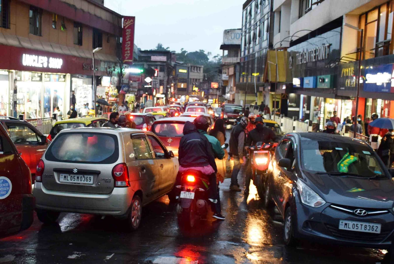
We left around 6pm, peak hour, and I finally saw it. Two-wheelers, cars, buses, everyone trying to get home, and us stuck in what must have been close to a kilometre of backlog. I was curious what was actually causing it, and as we inched closer I could see it was a three-way junction, one policeman, letting one approach through at a time. What struck me was that the other two approaches barely had 50 to 100 metres of queue. Ours had almost a kilometre. He had no way of knowing that from where he stood. A platform would have. It wasn't his fault, he was doing by hand what most cities build entire control rooms to do, and doing it with no data at all. It made something click for me. No city gets this right. Every resident, everywhere, loses some time to traffic they didn't need to lose. Our solution probably won't cut anyone's travel time in half. But it might stop it from doubling.
We don't have numbers for Shillong yet
We don't have numbers for Shillong yet the way we do for Pune. We will. We're still rolling out, training the different stakeholders responsible for traffic, and building specifically for how they work, because that's true of every city we go into. There's no plug-and-play version of this. We spend the time, and we build what actually fits.
I'm genuinely optimistic about the value we'll add there. And I'm even more convinced that the city itself is headed somewhere, the way it's thinking about its own future.
P.S. Shillong, and the areas around it like Cherrapunji, are absolutely gorgeous. Go if you get the chance.



Frequently asked questions
Does a smaller city like Shillong actually need traffic intelligence?
Congestion is felt in percentages, not minutes. A trip that used to take ten minutes and now takes twenty has doubled for the person making it, even though twenty minutes would count as a good commute in Delhi. Traffic in Shillong is still tolerable in a way it has not been in tier-1 Indian cities for years, and that is exactly the window in which decisions are still cheap to get right.
Does probe data work in a city where few people use navigation apps?
The sample is thinner than a metro's, but it is the only source a hill city will realistically ever have. You cannot put a sensor on every kilometre of a city built into hills. A representative sample you actually have beats a perfect sensor network you will never get.
How do cities use traffic data to plan new roads?
By simulating how people move today before committing concrete. The questions worth answering are where a new road should go, how many lanes it needs, and whether people would actually use it or keep taking the old route out of habit. Shillong is planning New Shillong as a new city alongside the old one specifically to decongest it, which makes those questions immediate rather than academic.
Which departments use a traffic platform inside a city government?
Traffic is not one department's job. Police, municipality and PWD each own a piece of it, and every city splits it a little differently. The intent in Shillong was to roll TraffiCure out to each of them for their own use case, rather than park it in a single office and call it done.
TraffiCure delivers real-time traffic intelligence for every road in your city, on existing data, with no civil work. See all features or book a demo to see your city's data.